This column was contributed by Chris Mielke, director of aerial and mobile mapping at Bowman, an engineering services firm.
The expansion of solar energy in recent years has surprised even ardent promoters of renewable energy. The International Energy Agency forecasts that solar capacity will nearly triple to over 2,350 GW by 2027, “surpassing hydropower in 2024, natural gas in 2026 and coal in 2027 to become the largest installed electricity capacity worldwide.” The dramatic fall in solar costs fuels this trend.
A factor is the work of engineering firms, which bring about significant cost savings by taking advantage of advances in separate technologies and combining them in new ways.
“Often, when we look back at past instances of a technology bringing sweeping changes across society, we see it is not only the big headline innovations that brought the changes about, but also many behind-the-scenes novel uses of innovations coupled with other technologies,” says my colleague Charles Powell, VP of the survey team.
The convergence of various technologies is an ever-unfolding narrative. A major area where this is happening is at the front end of projects, at the surveying stage.
Before construction begins, surveyors create high-precision maps that solar developers use to plan their buildouts. The work to create an industry-standard American Land Title Association (ALTA) survey involves conventional surveying to produce boundary, easement and utility information, along with LiDAR and photogrammetry to produce a combination of topography and planimetric features. All of which are essential for solar projects at a commercial or utility-scale.
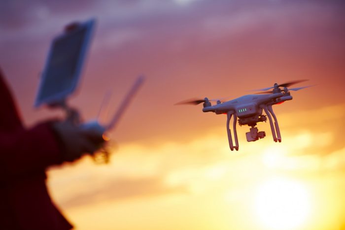
Engineering firms are increasingly using drones equipped with the latest LiDAR and global positioning systems to speed up that data collection.
LiDAR technology on unmanned aerial systems has only attained a level of dependability to support survey-grade undertakings within the last three years. While previous issues with manned aircraft and vehicle-mounted mobile systems had been resolved, unmanned aerial systems were still in development and faced issues related to the precision of smaller LiDAR sensors, which are just as complex as traditional sensors used in manned aircraft. Additionally, trajectory files that depend on GNSS measurements and the Internal Measurement Unit (IMU), which records the roll, pitch, and yaw of the aircraft’s sensors, posed challenges.
In 2023, cameras have higher resolution, batteries last longer, and payloads are lighter than just a few years ago. With more satellites now feeding into global navigation satellite systems like BeiDou and Galileo, accuracy is better than ever. LiDAR sensors have become smaller and lighter, making them more suitable for drone surveying. They also collect much more data, with a point density that rivals other ground-based systems.
The latest drone technology enables surveyors to program a drone to follow a specific flight path and complete the surveying task autonomously. The pilot is solely there to ensure flight safety.
A project that once would have taken three months now takes three days. This can lead to significant cost savings, although the actual amount may vary depending on the project’s complexity and location. Surveying a wooded site that previously would have cost $100,000 can be completed now for a fraction of the cost using drone surveying, with better data. For an open field, the savings is on the order of three to one.
Engineering firms are poised to speed up solar deployments even further. Last November, Bowman acquired SEI Professional Services, whose engineers serve developers and owners of solar projects at the commercial and utility scale. Our survey team has a combined fleet of 40 fixed-wing and rotary drones, with plans to add at least 10 more this year.
Important step changes like this can easily go overlooked.
Pre-construction work, such as ALTA surveys, takes place behind the scenes and often do not make exciting headlines, but advances at this stage deliver a fundamental and meaningful impact. The world may one day look back and point to this technological convergence as a game-changer at the same level as the faster-than-expected drop in costs of renewable power generation.
Solar deployment is already outpacing expectations. We’ve seen bookings for solar projects shoot up in the past few months — adding further optimism to a field once known more for bleak false starts than head-turning growth.
Chris Mielke is director of aerial and mobile mapping at Bowman, an engineering services firm.
— Solar Builder magazine

Leave a Reply
You must be logged in to post a comment.